Posted: May 19, 2023 at 8:20 a.m.
The tractor and pump that has been set up on Overwater Road at River Road (PR #230) is being removed and the road will re-open by 10am this morning.
Posted: April 24, 2023 at 5:00 p.m.
Some new drone footage was taken today of the Netley Creek and Wavey Creek areas. Flights were launched from 2 locations - Patricia Drive and Boyd Avenue.
The Province predicts the crest to hit Emerson this weekend or early next week so we should see the crest in Winnipeg by May 4.
Water levels have not increased over the last couple of days on the river or creeks and we currently see no concerns.
Posted: April 22, 2023 at 3:00 p.m.
New drone footage was taken this morning of the river and creeks at the End of Main Boat Launch (north end of Breezy Point Road/PR#320). Check out today's ice and water photos from on the river at the Cut, Netley Lake, Goldeye Lake as well as the Netley Creek and Wavey Creek areas.
There has been no real change since reported yesterday and no increase in water levels.
Next drone launch is planned for Monday, April 24 to focus more on the creek areas, weather permitting.
Posted: April 21, 2023 at 2:30 p.m.
There has been no real rise in water levels since the operation of the floodway began late yesterday. Conditions continue to look good for the creeks and river.
- The Floodway is operating under Rule 1, diverting 4,700 cfs this morning.
- Flood watch for Breezy Point has been removed from the Province's flood alerts.
- Temperatures to warm up to next week so may see more runoff.
- Another drone flight may take place this weekend of the Netley Creek area, dependent on weather conditions.
- The pump at Overwater Road & River Road has not yet been activated as there is no water to currently pump. Staff and equipment are prepared to act should water levels increase and pumping is required.
We will continue to monitor water levels over the next week but there are no concerns at this time.
Posted: April 20, 2023 at 4:50 p.m.
The Red River Floodway was activated this afternoon at 4:30 pm. The initial raise is expected to have a minor impact at the inlet.
Posted: April 20, 2023 at 3:00 p.m.
There has been no significant changes today in water levels and the storm system did not bring any major precipitation to our area. Levels on the creeks in Petersfield are stable and not of any concern at this time. The RM has not yet received any notification as to when the operation of the floodway will begin.
Posted: April 19, 2023 at 9:00 a.m.
The ice on the river has now moved north up past the End of Main (north end of Breezy Point Road/PR #320) into 'the Cut' area. There should no longer be any threat of ice jamming. The Province has advised they will be opening the floodway gates tomorrow, Thursday, April 20, but no time has been given at this point, so we may see water levels rise over the next several days. Water levels have risen approx. 1 foot since yesterday along Netley Creek, but there are no concerns at this point. We will be continuing to monitor water levels and any impact this impending storm may have.
Road Closure: We will be setting up a tractor and pump at Overwater Road and River Road at noon today (Wed, April 19) so this area will be closed and barricades put up. We ask that the public please refrain from moving these barricades as they are there for public safety.
Posted: April 18, 2023 at 2:30 p.m.
A drone flight took place this morning at 10am at McIvor Lane South. New photos and videos have been uploaded for everyone to see on our Flood 2023 Photos and Videos webpage. The water is now open just south of McIvor Lane South and the ice is starting to break up and move in this area. The next drone flight will be dependent on weather conditions and ice location.
There is a storm system expected over the next couple of days and at this point, we don't know how it will impact the river or overland flooding. A meeting was held virtually with EMO today, and the floodway operation is expected by Friday or on the weekend. The RM will be notified prior to this occurring.
Levels on Netley Creek at Petersfield rose 1 foot from yesterday to 719.6. You can also view the river levels on today's Red River Daily Flood sheet.
We continue to monitor conditions daily and will provide updates as soon as they become available.
Posted: April 17, 2023 at 4:00 p.m.
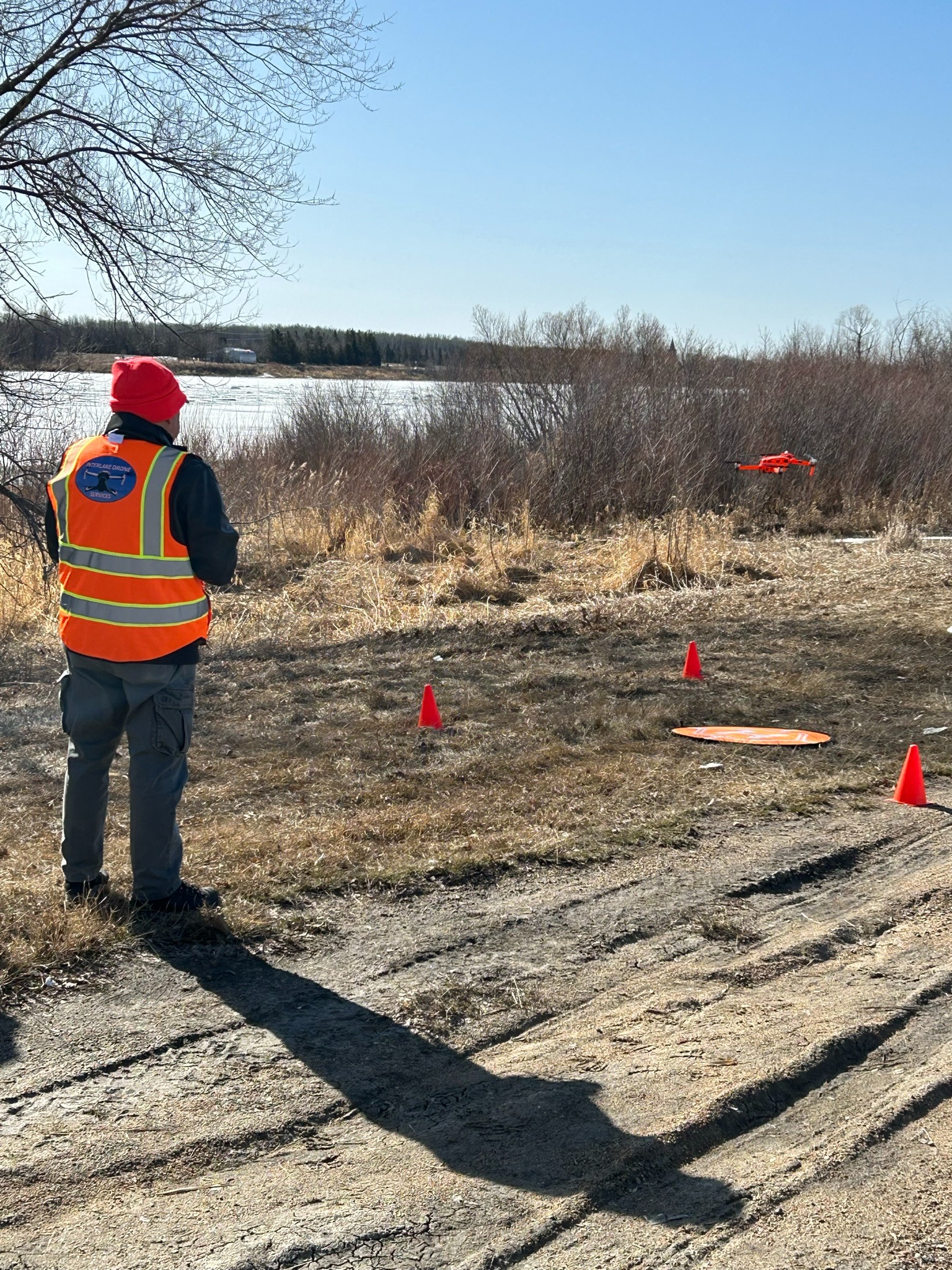 Drone footage provided by Interlake Drone Services of Gimli
There is currently open water up to the Selkirk Park area and there are no problems with any ice build up at this time.
Drone flights were conducted earlier today at the Highway #4 bridge area (on each side of the bridge) as well as the End of Main Boat Launch (Netley Creek/Patricia Drive/The Cut). Several photos and videos have now been uploaded for your viewing - Flood 2023 Photos and Videos webpage.
The flow in the Red River is increasing – it was 31,924 cfs at 1pm today. That is approx. 5,000 increase overnight. The level at Selkirk dock is 719.9 feet (about a 1 foot rise from yesterday) and the level at Breezy Point is 715.10 feet.
The ice still appears to be melting nicely. There is precipitation forecasted for Wednesday and Thursday but we don’t foresee any major problems but this may delay future drone flights due to the weather.
Overland flooding – no concerns. Public Works are out steaming culverts as necessary.
Our next drone flight is planned for April 18 at South McIvor Lane.
Posted: April 14, 2023 at 8:45 p.m.
At 6:30 p.m., we did an initial drone flight of the Red River and ice conditions in the vicinity of the Willow Springs Campground (along PR #320/Breezy Point Road) just north of Clandeboye Road. There are no concerns at this time as the river is still frozen with no ice movement.
We will be monitoring conditions daily and if there are any significant changes, we will provide more updates. We don't anticipate anything concerning over the weekend but will still be monitoring conditions.
Plans are in place to do the next drone flight on Monday morning (April 17) weather permitting, in the vicinity of the Highway #4 Bridge and we will upload more imagery that day.
Posted: April 13, 2023
There has been a significant decrease in the snow pack throughout the municipality and the creeks are mostly open and flowing but not over their banks. The ditches do not seem to have much water in them but public works crews will be out steaming culverts as necessary.
The Red River is open to the Lockport dam and the ice is deteriorating nicely. The flow is not that heavy at this time so there's not a big push to break the ice which is good. The longer we have for the ice to rot before a heavy flow comes this way lessens the chance of ice jamming.
Netley Creek has increased a fair bit in the last 12 hours but does not appear to be a concern as the melt off the fields should be decreasing shortly.
Currently, Selkirk's flow is 6212 cfs and only 714.8 ft and Breezy Point is 713.11 ft.
Although there is some rain expected in the forecast, it is unlikely to be anything of significance.
Posted: March 30, 2023
Preparations continue for the upcoming spring thaw. The RM's Emergency Response Team held their latest meeting on March 30, 2023 to review all action plans for any possible overland or river flooding. Interlake Drone Services will be doing flyovers of the ice movement along the river when it comes into the Selkirk area. Photos and videos will then be posted to our Flood Information Webpage and YouTube Channel along with daily updates.
All the main drains have now been cleaned and steamers are ready to go. Once the melt begins, any frozen culverts will be steamed by public works staff as deemed necessary.
There will be empty sandbags and sand (sand/salt mixture) available at our Public Works Shop in Clandeboye as well as the South Fire Hall (5610 Highway #9).
The RM does not look after the ditches or blocked culverts along any provincial road or highway. You can contact the Highways Dept. (MTI) at 204-346-6266.
Posted: March 22, 2023
The RM's emergency response team continues to meet regularly and is working closely with EMO (Manitoba Emergency Measures Organization) and the Province in flood preparation planning. On March 21, 2023, the Province released it's March 2023 Flood Outlook report.
Posted: March 7, 2023
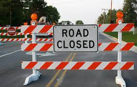 Once the spring thaw begins, there will likely be water encroaching onto some roadways and it may be necessary to close a road or erect barricades. There have been numerous occasions where individuals pass through these barricades which poses a danger to not only themselves, but others as well, including emergency responders who may have to perform a rescue. Generally local traffic would be allowed access to their homes unless the situation poses an immediate danger to one's life.
The Province amended The Highway Traffic Act (c.c.s.m. cH60) in recent months, which gives peace officers, fire fighters and other designated personnel the authority to close a roadway due to unsafe road conditions, road works and other emergency situations. Driving on a closed roadway or around erected barricades is an offence and you could be liable to a fine.
We encourage the public to familiarize themselves with Sections 76.1(1) to 76.2(3) of The Act.
Posted: March 1, 2023
The Province issued its first spring flood outlook on February 28, 2023. You can view the notice here.

Province's Flood Outlook Information
To view the Province's latest flood outlook information and news releases, please click on the following link:
https://www.gov.mb.ca/flooding/index.html
To view the Government of Canada's Real-Time Hydrometic Data Graph for Netley Creek near Petersfield, please click on the following link: https://wateroffice.ec.gc.ca/report/real_time_e.html?stn=05OJ008
To view the Government of Canada's Real-Time Hydrometic Data Graph for Breezy Point, please click on the following link:
https://wateroffice.ec.gc.ca/report/real_time_e.html?stn=05OJ022

February 16, 2023
MANITOBA GOVERNMENT ANNOUNCES
ICE-JAM MITIGATION SCHEDULED ON RED RIVER
- - -
Program Provides Continued Vigilance,
Preparedness in Strategic Planning: Piwniuk
The Manitoba government’s yearly ice-cutting program will begin next week on the Red River to reduce the potential impacts for ice-jam flooding, Manitoba Transportation and Infrastructure Minister Doyle Piwniuk announced today.
“Our government is remaining vigilant by implementing the ice-jam mitigation program in order to protect Manitobans in the chance of flooding due to ice jamming,” said Piwniuk. “As part of the mitigation strategy, the Manitoba government is committed to further advancing preparedness solutions including ice-cutting operations in the province.”
The ice-jam mitigation program, which consists of cutting and breaking river ice, was launched in 2006 to reduce the risk of flooding caused by ice jams on the lower Red River and several other rivers. Ice jams form when floating ice is blocked from moving downstream, forcing water to back up and overflow riverbanks.
Remote controlled ice-cutting units and three Amphibex icebreakers are used each year to cut and break approximately 28 kilometres of ice on the Red River from Selkirk to Netley Marsh for an approximate width of 100 metres. Ice-cutting and breaking operations are also often undertaken on the Icelandic River at Riverton and at the outlet of the Portage Diversion.
Currently, ice-cutting operations are also planned on the Icelandic River in mid to late March, but are not expected to be required at the Portage Diversion. Conditions in the Assiniboine River basin will continue to be monitored to determine whether icebreaking activities at the Portage Diversion become warranted.
Notices have been posted in areas where ice-cutting machines will be working. River users are advised as a safety reminder to stay off ice where notices are posted or where evidence of recent ice cutting is apparent. Ice fishers are also reminded to remove huts or other materials in areas covered by the ice-jam mitigation program.
The icebreaking and ice-cutting equipment is operated and maintained by Winnipeg Environmental Remediations Inc., a Manitoba company that provides comprehensive environmental services, general contracting and civil earthworks.
Posted: January 20, 2023
The Province will be releasing it's first spring flood forecast in the upcoming weeks. Preparations are underway by the municipality for the upcoming thaw. All main drains will be cleaned first so that ditches are able to drain once the melt begins and any frozen culverts will be steamed by public works staff as deemed necessary.
If you do experience water problems, please submit a service request so it gets into our tracking system. These requests get submitted immediately to our Public Works staff via email and it makes it easier for them to prioritize the submissions based on risk levels. If using your phone to submit a service request, you must download our App first and do it through the App. A service request cannot be submitted on the phone without the App.
What you need to do if your property is at risk this spring?
- Monitor the spring melt and watch for anything abnormal in your area and protect your home and property as necessary; empty sandbags and sand will be available
- Know the notification/warning systems the RM uses:
- Municipal website (www.rmofstandrews.com)
- Media (Selkirk Record)
- CONNECT Notification System (Text/Email/Phone Call - only if you have registered; if you haven't registered, sign up now here: Register for CONNECT
- Protect your pets and livestock
- Take special precautions to safeguard electrical, natural gas or propane heating equipment. This may include turning off electricity to the affected areas of your home
- Move furniture, electrical appliances, valuables and personal belongings to floors above ground level
- Contact your insurer to make sure you are covered for flood insurance if your property is at risk
- The RM is not responsible for individual property protection, does not deliver sandbags and will not provide staff to install them
- Protect all openings, holding tanks, drinking water supply and septic fields that may be at risk
There are some great fact sheets and resources of information on our Flood Fact Sheets page that can provide guidance and assistance in preparing for possible flooding situations.
 CONNECT With St. Andrews
Register with CONNECT, our communication system that allows us to contact you quickly in a way that works for you…by voice message, on your land line telephone, by text or voice message on your cell phone or by e-mail. Stay informed of all the latest news, upcoming events, emergency alert messages and more.
During an emergency or flood situation, we are able to map out specific areas and send important notifications to those registered individuals in the specified area immediately. It is a very useful and important tool for us to communicate with you so please register today!