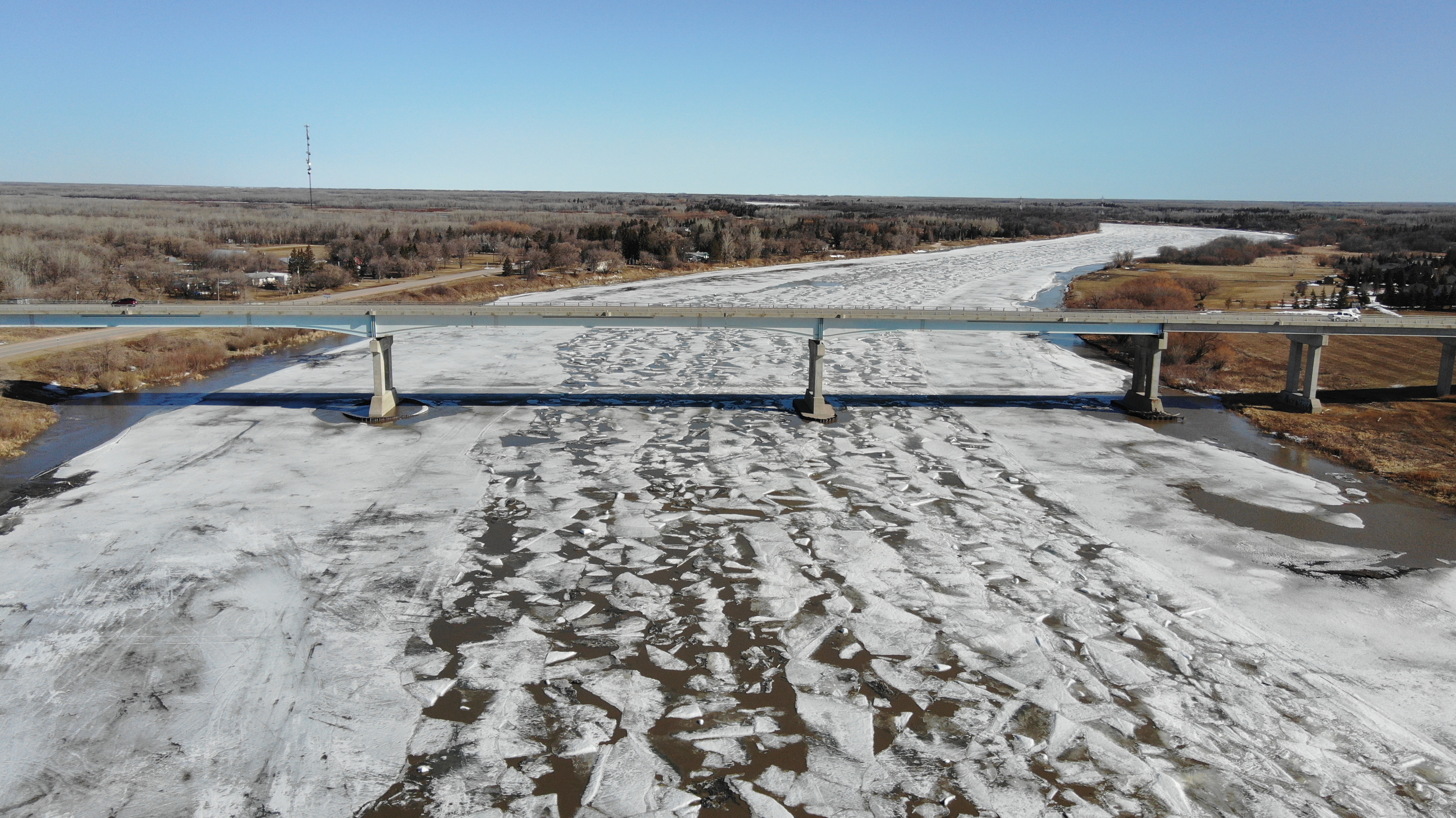
 Hwy #4 Bridge - Photo captured on April 17, 2023RM personnel have been closely monitoring conditions along the Red River and the ice has now moved out of the area. We have done some drone coverage and posted videos and photos to capture the river's break up and movement. These images have allowed us to monitor for any potential risk of jamming and to see it's location each day.
Some areas of interest will often be mentioned such as the Cut, Willow Springs Campground, Goldeye Lake and End of Main. Here is a map identifying these particular areas to help you better understand the location we are referring to in our photos and videos.
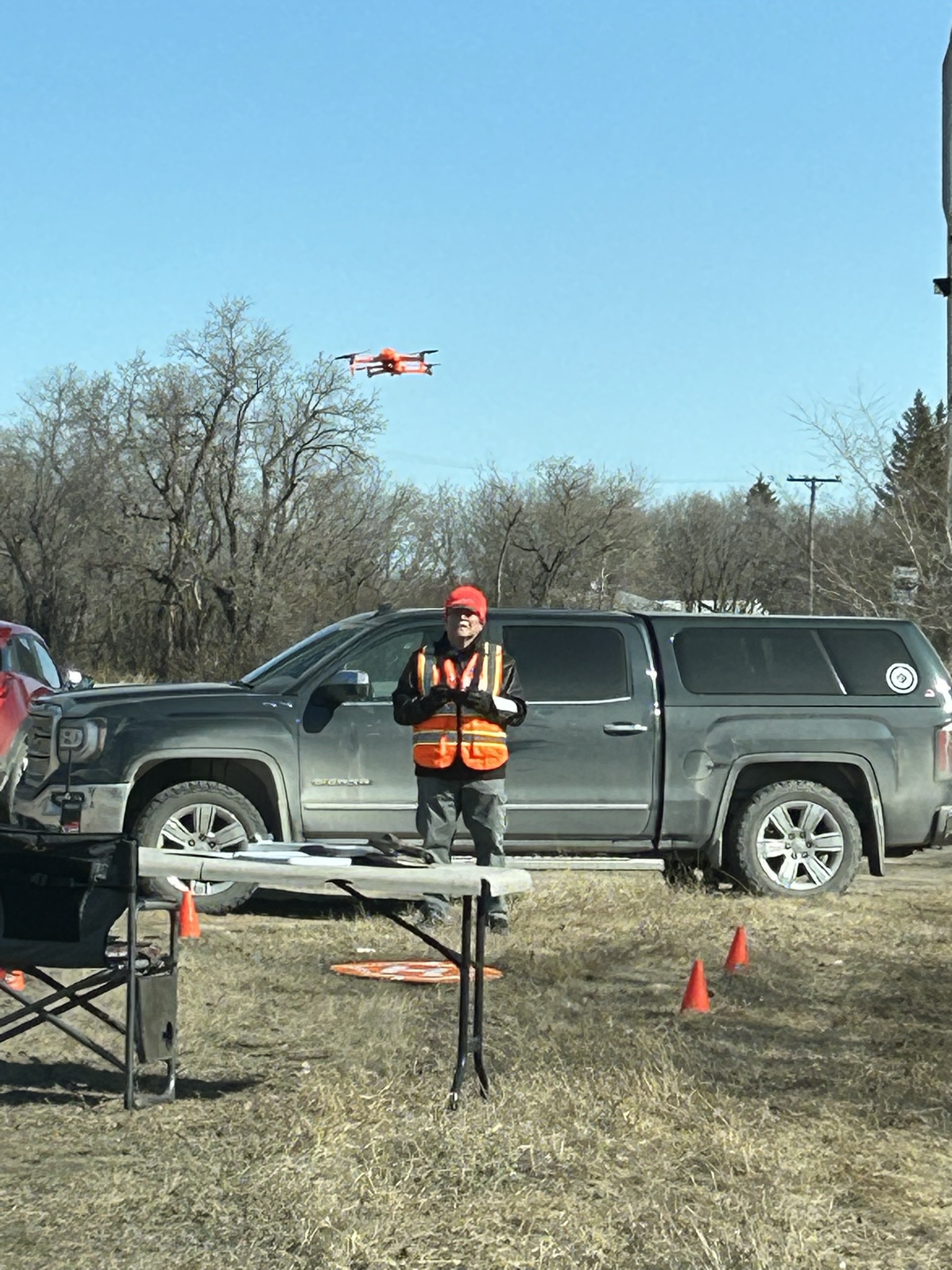 Interlake Drone ServicesWe have created a new Flood 2023 Playlist on our YouTube Channel for watching the videos and will provide links below to the photos that have been captured by our drone operator, Steve Bannister and his team at Interlake Drone Services.
April 24, 2023 - 1:00 p.m. - 3:00 p.m. - Water and Ice Photos - Wavey and Netley Creek Areas
- Wavey Creek looking south from Patricia Drive - April 24, 2023 at 1:00 p.m.
- Wavey Creek heading south as it meets Muckles Creek - April 24, 2023 at 1:00 p.m.
- Muckles Creek (at left) at Wavey Creek (at right) - April 24, 2023 at 1:00 p.m.
- Wavey Creek looking north to Netley Creek at Patricia Drive - April 24, 2023 at 1:00 p.m.
- Wavey Creek at Netley Creek at Patricia Drive area - April 24, 2023 at 1:00 p.m.
- Netley Creek looking west from Patricia Drive - April 24, 2023 at 1:00 p.m.
- Netley Creek looking east towards the river from Patricia Drive - April 24, 2023 at 1:00 p.m.
- Netley Creek at the River - End of Main Boat Launch Area - April 24, 2023 at 1:00 p.m.
- Netley Creek looking east from Boyd Avenue - April 24, 2023 at 2:45 p.m.
- Netley Creek looking south from Boyd Avenue - April 24, 2023 at 2:45 p.m.
- Netley Creek looking west from Boyd Avenue - April 24, 2023 at 2:45 p.m.
- Netley Creek looking west from Boyd Avenue - April 24, 2023 at 2:45 p.m.
- Netley Creek looking east from Boyd Avenue - April 24, 2023 at 2:45 p.m.
April 22, 2023 - 10:00 a.m. - 12:00 p.m. - Water & Ice Photos - River at the Cut Area, Goldeye Lake, Netley Creek and Wavey Creek Areas
- River looking north to the Cut at Netley Lake - April 22, 2023 at 10:00 a.m.
- River at the Cut at Netley Lake - April 22, 2023 at 10:30 a.m.
- The Cut at Netley Lake and the river heading north past the Cut - April 22, 2023 at 10:30 a.m.
- River looking south from End of Main at Netley Creek to Goldeye Lake - April 22, 2023 at 11:00 a.m.
- Goldeye Lake - on west side of the river south of End of Main - April 22, 2023 at 11:00 a.m.
- Heading north on the River from Goldeye Lake - April 22, 2023 at 11:00 a.m.
- River at Netley Creek looking north into Netley Lake at the Cut - April 22, 2023 at 11:00 a.m.
- Netley Creek heading west from the river at End of Main - April 22, 2023 at 11:00 a.m.
- Netley Creek heading west from the river at End of Main - April 22, 2023 at 11:00 a.m.
- Netley Creek at Wavey Creek at Patricia Drive area - April 22, 2023 at 11:30 a.m.
- Wavey Creek heading south from Netley Creek at Patricia Drive area - April 22, 2023 at 11:30 a.m.
- Netley Creek heading west from Wavey Creek at Patricia Drive area - April 22, 2023 at 11:30 a.m.
- Netley Marsh off of Netley Creek - April 22, 2023 at 11:30 a.m.
- Netley Creek heading east to river and then up to the Cut - April 22, 2023 at 11:30 a.m.
April 18, 2023 - 10:00 a.m. - Ice Photos - River at McIvor Lane South Area
- River looking north from McIvor Lane South - April 18, 2023 at 10:00 a.m.
- River looking south from McIvor Lane South - April 18, 2023 at 10:00 a.m.
- River looking south from McIvor Lane South - April 18, 2023 at 10:00 a.m.
- River looking north from McIvor Lane South - April 18, 2023 at 10:00 a.m.
- River looking north from McIvor Lane South - April 18, 2023 at 10:00 a.m.
- River looking south from McIvor Lane South - April 18, 2023 at 10:00 a.m.
April 17, 2023 - 12:30 p.m. - Ice Photos - River at Netley Creek Area
- River looking south from End of Main Boat Launch to Goldeye Lake - April 17, 2023 at 12:30 p.m.
- River looking south from End of Main Boat Launch to Goldeye Lake - April 17, 2023 at 12:30 p.m.
- River by Goldeye Lake facing north to the Cut - April 17, 2023 at 12:30 p.m.
- River looking north from Goldeye Lake to the Cut - April 17, 2023 at 12:30 p.m.
- River at Netley Creek - April 17, 2023 at 12:30 p.m.
April 17, 2023 - 12:00 p.m. - Ice Photos - Netley Creek at River Area / Patricia Drive Area
- Netley Creek heading west towards Patricia Drive from river - April 17, 2023 at 12:00 p.m.
- Netley Creek heading west towards Patricia Drive from river - April 17, 2023 at 12:00 p.m.
- Netley Creek at Patricia Drive - April 17, 2023 at 12:00 p.m.
- Netley Creek heading west towards river (bend/marsh) - April 17, 2023 at 12:00 p.m.
- Netley Creek heading east to river - April 17, 2023 at 12:00 p.m.
April 17, 2023 - 11:30 a.m. - Red River/Ice Photos - End of Main Boat Launch Area
- The Cut - North of End of Main Boat Launch Area facing north - April 17, 2023 at 11:30 a.m.
- The Cut - North of End of Main Boat Launch Area facing north - April 17, 2023 at 11:30 a.m.
- North End of The Cut - End of Main Boat Launch Area facing north - April 17, 2023 at 11:30 a.m.
- From the Cut looking south to Netley Creek/End of Main Boat Launch - April 17, 2023 at 11:30 a.m.
April 17, 2023 - 10:30 a.m. - Red River/Ice Photos - Highway #4 Bridge Area
- River at Highway #4 Bridge facing south - April 17, 2023 at 10:30 a.m.
- River at Highway #4 Bridge facing north - April 17, 2023 at 10:30 a.m.
- River at Highway #4 Bridge - north side of bridge facing north - April 17, 2023 at 10:30 a.m.
- River at Highway #4 Bridge - north side of bridge facing south - April 17, 2023 at 10:30 a.m.
- River at Highway #4 Bridge - north side of bridge facing south - April 17, 2023 at 10:30 a.m.
April 14, 2023 - 6:30 p.m. - Red River/Ice Photos - Willow Springs Campground Area
- River facing south at Willow Springs Campground (along Breezy Point Road/PR #320 just north of Clandeboye Road) - April 14, 2023 at 6:30 p.m.
- River facing north at Willow Springs Campground (along Breezy Point Road/PR #320 just north of Clandeboye Road) - April 14, 2023 at 6:30 p.m.
- Close up of ice on the river at Willow Springs Campground Area (along Breezy Point Road/PR #320 just north of Clandeboye Road) - April 14, 2023 at 6:30 p.m.